
Spatial Thoughts Newsletter #24
Dynamic World, Earth Engine Commercial, Upcoming Classes, Landsat LST

Thanks for reading my newsletter. Special shoutout to the new subscribers! Read on for new learning resources for QGIS, Python, Google Earth Engine, GDAL and more.
New Dataset: Dynamic World Global Landcover Classification
The big announcement this month was the availability of a new dataset called Dynamic World by Google. This is an exciting announcement for researchers working on Earth Observation and Climate Change. It significantly reduces barriers for a whole range of applications - thanks to the near real-time probability-based dataset that generates a 9-class classification for each individual Sentinel-2 image captured since 2015.
I had received early access to this dataset and collaborated with the Google Earth Outreach team to develop a series of tutorials that will help you start working with this dataset in Google Earth Engine. Interested? Read my summary and then head over to the tutorials.
Upcoming Classes
We have 2 new weekday batches scheduled in July. These instructor-led cohort-based sessions offer you the fastest way to ramp up your skills and they come with free lifetime support!
Customizing QGIS with Python (with QGIS.org certification) 12-13-14 July 2022
Advanced QGIS (with QGIS.org certification) 28-29 July 2022
Limited seats. Student discounts are available!

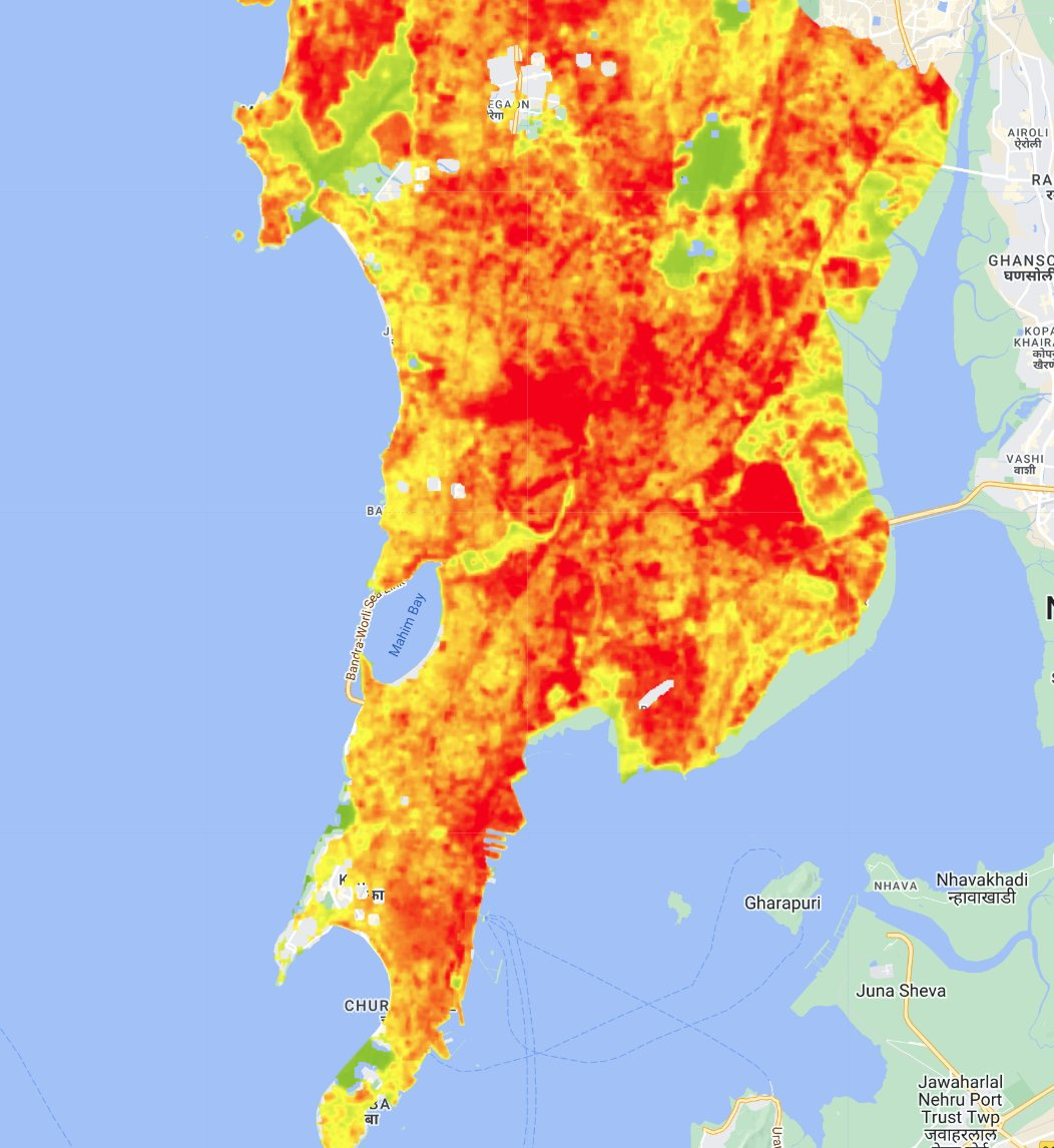
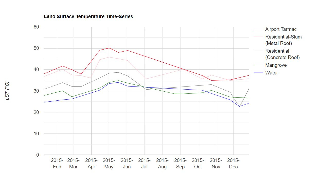
Featured: Land Surface Temperature (LST) Analysis
Many researchers are interested in studying the effects of climate change and the urban environment. Computing LST from satellite products used to be hard and time-consuming - but no more. Now with the availability of open-source libraries and cloud-based processing, you are able to study and map these interactions at high spatial and temporal resolutions easily.
I built an example showing how different land uses affect the land surface temperature. Not only you can visualize these at 30m spatial resolution anywhere in the world, but also extract a time series over long periods of time. You can customize it for your region and time periods easily with just the basic knowledge of Google Earth Engine.
Check out the full earthengine script with the explanation.
News and Learning Resources
How many people use QGIS every day? Which version is the most popular one? Which country has the largest QGIS userbase? QGIS team released the new Analytics Dashboard at https://analytics.qgis.org that contains various usage statistics. Read the blog post to understand the privacy-preserving methodology used to collect this information.
Google Earth Engine is now available commercially. Google finally revealed the commercial usage terms and pricing for the Earth Engine platform. This is great news for all users. It reaffirms that GEE will continue to stay free for non-commercial use - including for research and education - while providing a path for commercial users to leverage this technology.
QGIS version 3.26 launched in June with a lot of exciting new features. My favorite way to catch up on the new stuff is the visual changelog. The highlight of the release is the new Elevation Profile tool. Nyall Dawson did a deep dive video showing its capabilities.
Measuring road and river widths from spatial datasets are difficult tasks to accomplish reliably. I asked my twitter followers for recommendations and discovered some really good open-source tools to make this easy. The top ones are the Chordial-Axis QGIS Plugin and Sidewalk Widths NYC Python Notebooks to generate widths from polygons.
Hiring Alert!
I am hiring a full-time/part-time Training Associate to work with me. If you are passionate about geospatial tech and education - do check out the job opening and apply!